BeamWeatherGet the app

Features.

3D radar.

One cell, the area around it, or the whole scan out to 140 miles, standing over the map. Orbit, pan, and pinch down into a single core.
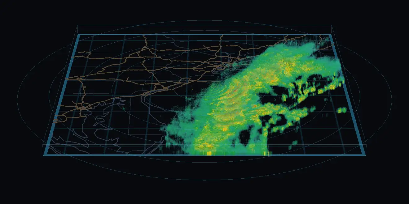
A wide three-dimensional radar box over New Jersey and the coast, with a long line of storms standing in it.
KDIX, the whole scan out to 140 miles.Radar data: NOAA/NWS NEXRAD — rendering by BeamWeather
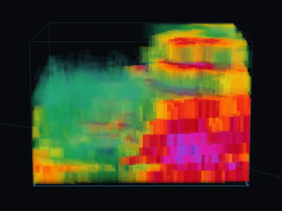
One storm cell in three dimensions, seen from low down: a tall column of reflectivity with a magenta core inside it.
KLSX, one cell.Radar data: NOAA/NWS NEXRAD — rendering by BeamWeather
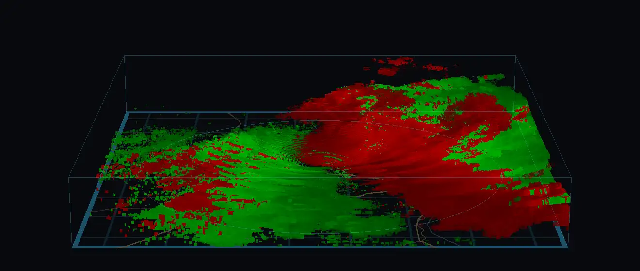
Radar velocity in three dimensions over St. Louis: air moving toward the radar in green and away from it in red, standing as solids above the map.
KLSX, velocity.Radar data: NOAA/NWS NEXRAD — rendering by BeamWeather

Velocity in 3D, too. A rotation couplet is a shape inside the storm.

The wind in 3D.

Every level from the surface to the jet stream, moving at its real height. Or lay the wind flat across the radar map.
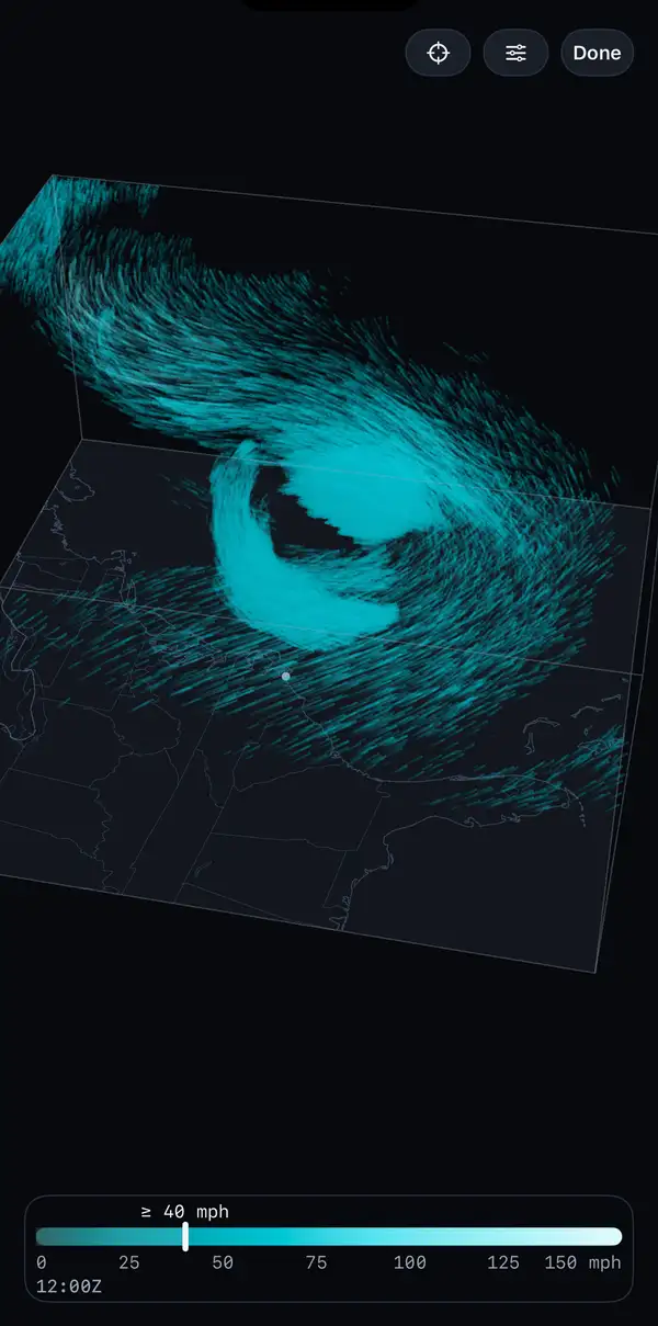
An iPhone showing BeamWeather's 3D wind: cyan particle trails at several heights circling a storm center over the East Coast, with a wind speed scale at the bottom.
October 19, 2026, the nor'easter off the Carolinas.Radar data: NOAA/NWS NEXRAD — rendering by BeamWeatherWind data: NOAA NCEP GFS — rendering by BeamWeather
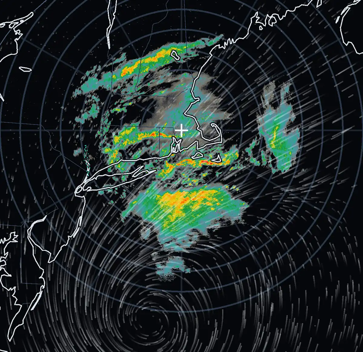
A radar map of southern New England with rain bands in greens and yellows, and white wind trails curving around a low-pressure center south of Cape Cod.
KBOX, September 26, 2026. Surface wind over the radar.Radar data: NOAA/NWS NEXRAD — rendering by BeamWeatherWind data: NOAA NCEP GFS — rendering by BeamWeather

Live Level II radar.

Reflectivity, velocity, spectrum width and dual-pol, from the station as each scan arrives.
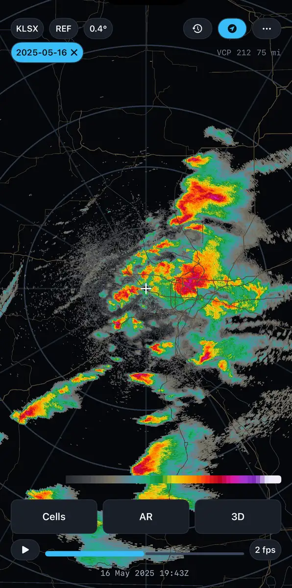
BeamWeather's flat radar view around St. Louis: storms in greens, yellows, reds and magentas over a map with range rings, and the date and scan time on the timeline.
KLSX, reflectivity, May 16, 2025.Radar data: NOAA/NWS NEXRAD — rendering by BeamWeather
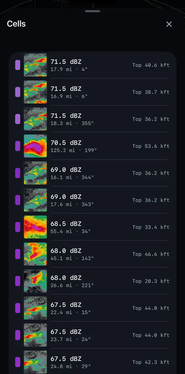
A list of storm cells over a radar view, each row showing a small plan thumbnail with peak intensity, distance and echo top.
KLSX, every cell in the scan.Radar data: NOAA/NWS NEXRAD — rendering by BeamWeather

Storm cells.

Every cell in the scan, strongest first, with peak intensity, echo top and VIL.
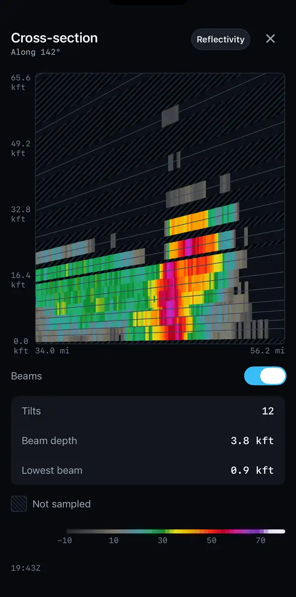
A vertical cross-section through a storm, height against distance, with the radar beam paths drawn as diverging lines and the space between them left empty.
KLSX, a slice through the storm.Radar data: NOAA/NWS NEXRAD — rendering by BeamWeather

Cross-sections.

A vertical slice through the storm. Where no beam reached stays empty.
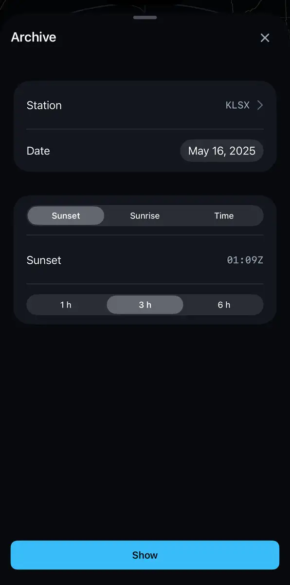
The archive screen with KLSX, May 16, 2025, a sunset start and a three-hour length selected.
KLSX, May 16, 2025, from sunset.Radar data: NOAA/NWS NEXRAD — rendering by BeamWeather

The archive.

Pick a station and a day. Start at sunset, sunrise, or any time you like.
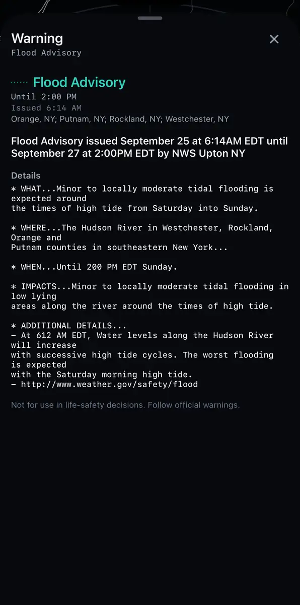
A National Weather Service flood advisory shown in full, with its expiry time and the official text below it.
A flood advisory, in the Weather Service's own words.Radar data: NOAA/NWS NEXRAD — rendering by BeamWeather

Watches and warnings.

National Weather Service alerts drawn over the radar, with the full text. Get a notification when one covers you.

Not for use in life-safety decisions. Follow official warnings.

AR.

Put a storm on the table and walk around it.

Radar sees rain, not cloud.

Get BeamWeather.

Download on the App StoreGet it on Google Play

iPhone, iPad and Android.